Aconcagua z Cerro Champaqui 480+ REKORD ŚWIATA!!!!!
Co tu dużo pisać. Czekaliśmy na tą obserwację z utęsknieniem. Jest to drugie podejście Roberto Antezana i Gabrieli Vollmer z Chile, do tej miejscówki będącą najwyższym punktem w Górach Sierras de Crodoba w Argentynie.
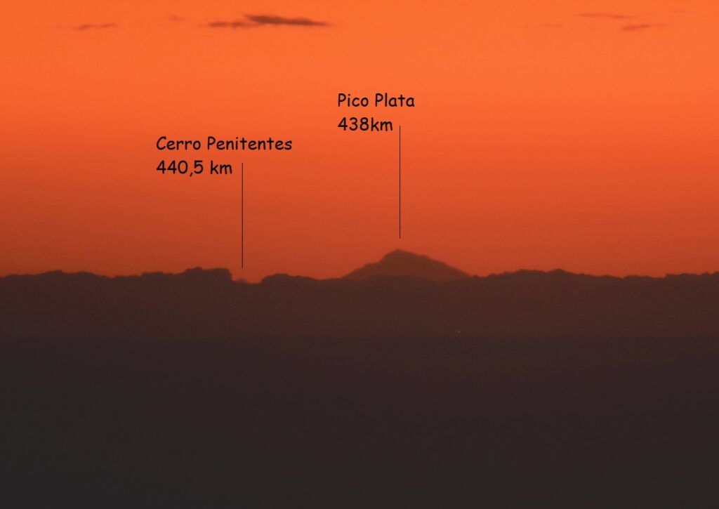
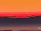
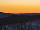
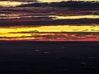
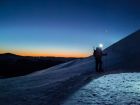
4 maja 2023 Roberto i Gabriela podjęli próbę ustanowienia tego rekordu jednakże nie udało się. Za punkt strzelecki obrali sobie odcinek szlaku pomiędzy Cerro Los Linderos a Cerro Champaqui i oto co wtedy przywieźli – niebotyczne odległości i piękne fotografie całej wyprawy:
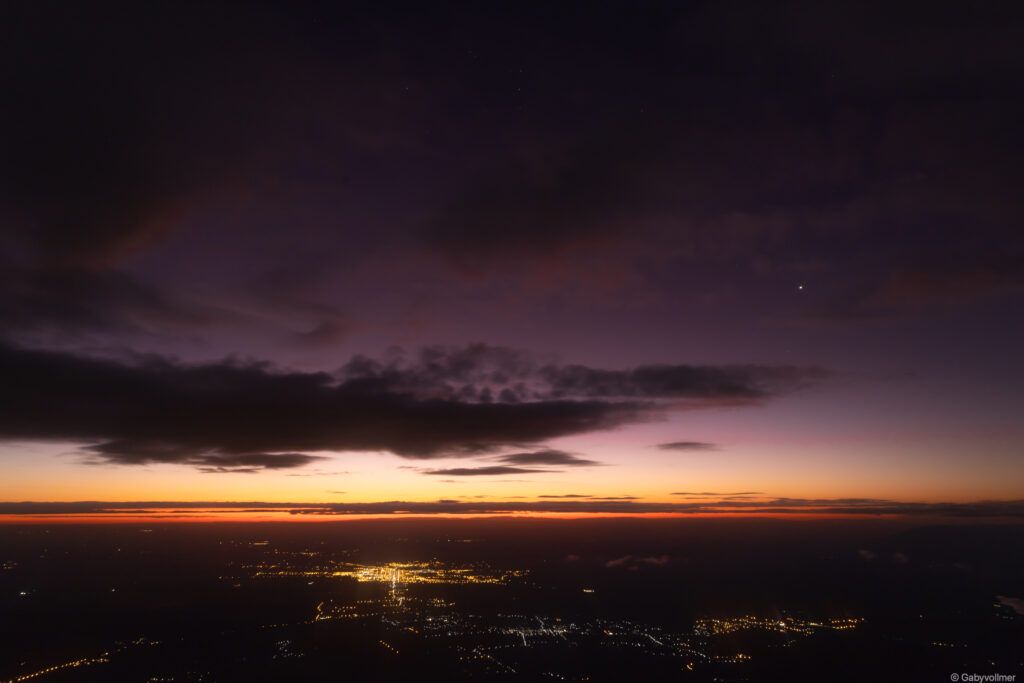
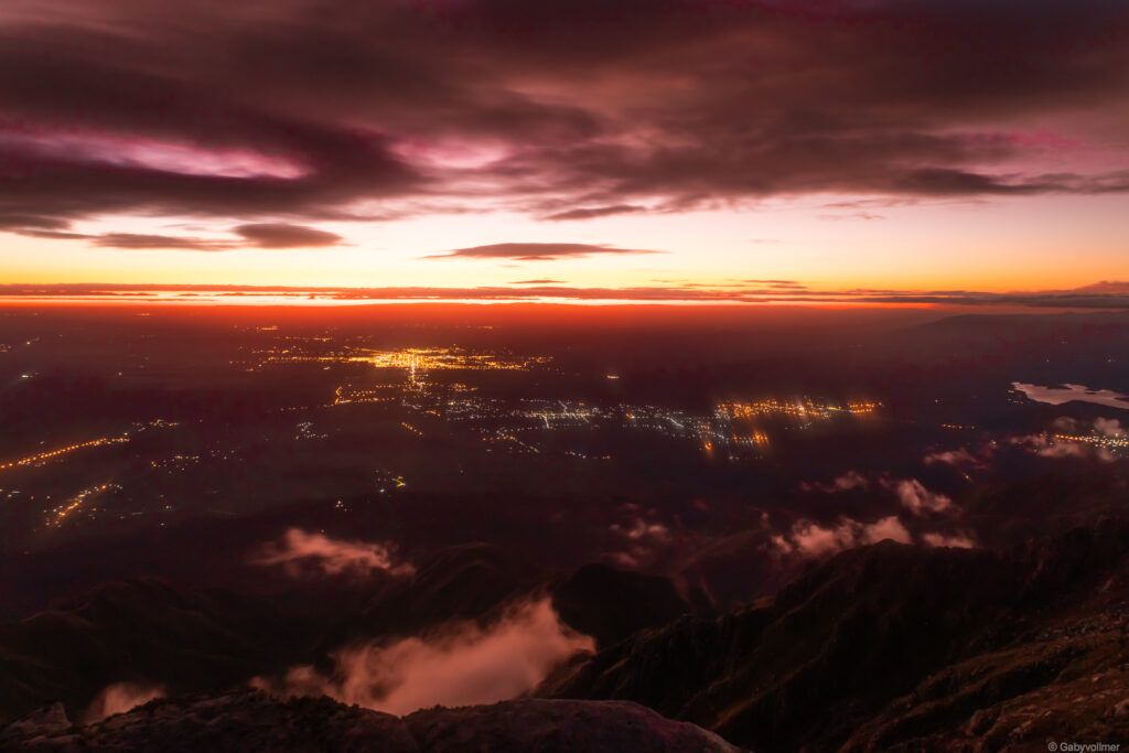
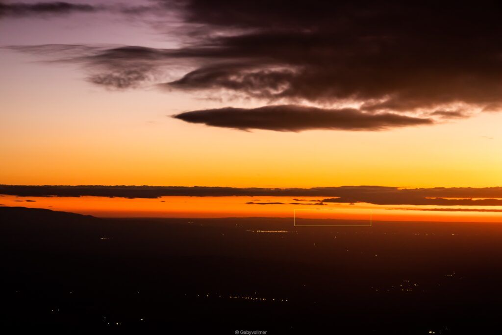
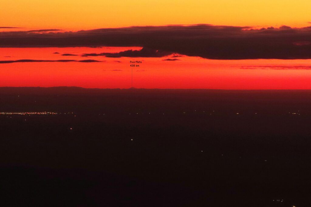
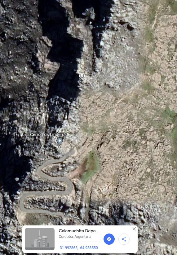
Miejsce obserwacji:
31°59’34.4″S 64°56’18.9″W
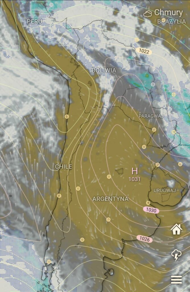
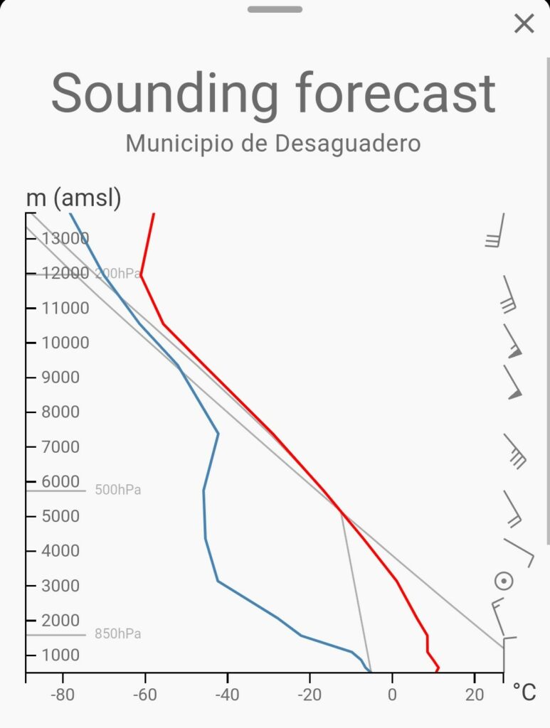
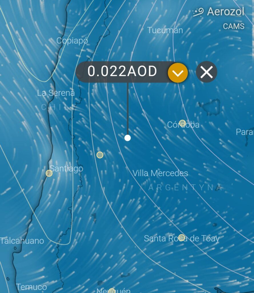
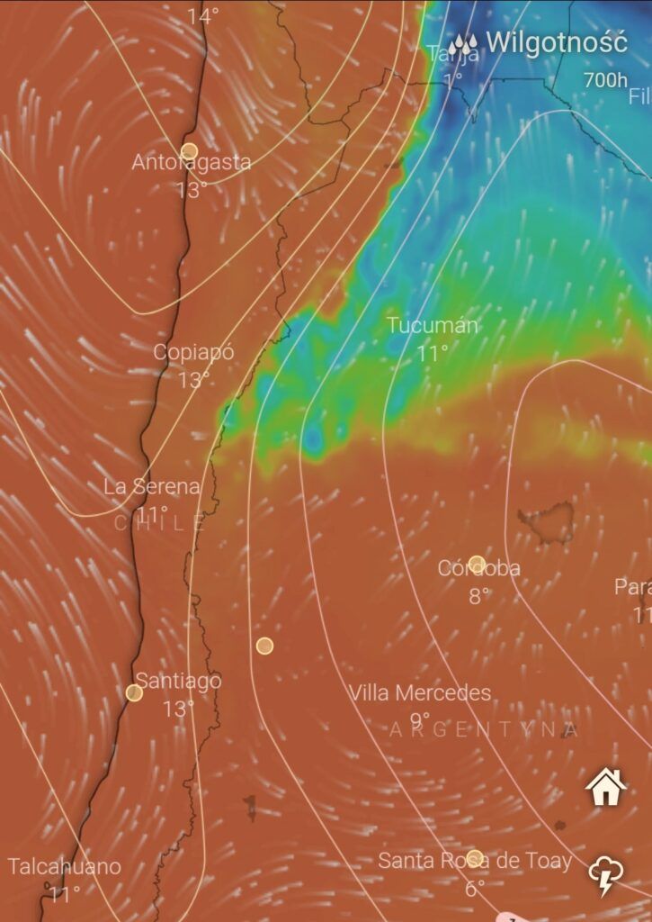
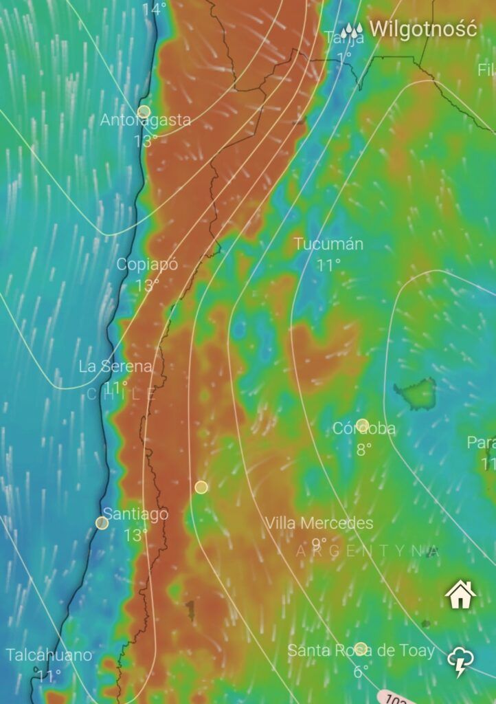
13. czerwca natomiast nasi bohaterowie udali się raz jeszcze w to miejsce tym razem na sam szczyt Cerro Champaqui. Nie bez powodu. Nad centralną Argentyną zadomowił się spory ośrodek wysokiego ciśnienia z suchym kontynentalnym powietrzem i niską wilgotnością na dużych wysokościach. Zobaczcie sami jak prezentują się mapy warunków w tej okolicy: niska wilgotność, inwersja, bezchmurne niebo i aerozol który w naszych rejonach jest niespotykany…
Tak przedstawia się symulacja z Cerro Champaqui przy uwzględnieniu współczynnika refrakcji 0,17

Oraz poglądowy zasięg widoczności tej obserwacji:
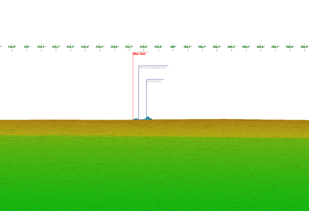
Przy współczynniku refrakcji rzędu 0,16 widoczność szczytu Aconcagui z Cerro Champaqui nie zostaje zaburzona w oparciu o model SRTM3 co obrazuje wykres z witryny Heywhatsthat:

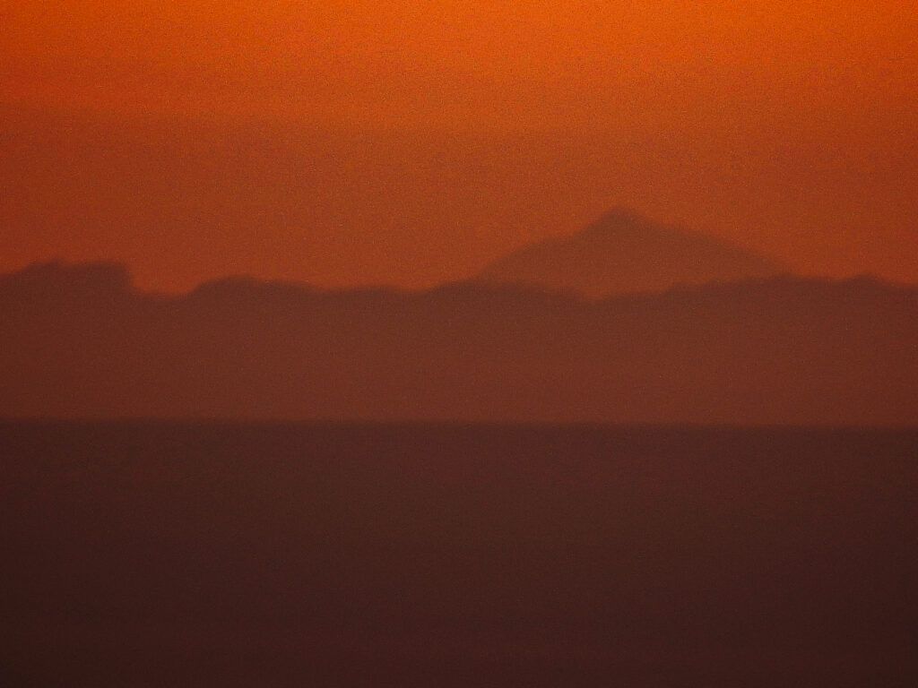
No ale dość tej teorii i przejdźmy do sedna. Na początek majestatyczny szczyt Pico Plata bagatela 438 km:
Wycinek symulacji w rodzielczości aparatu: (RC0,16):
I przed państwem widoczny malutki stożek Aconcagui:
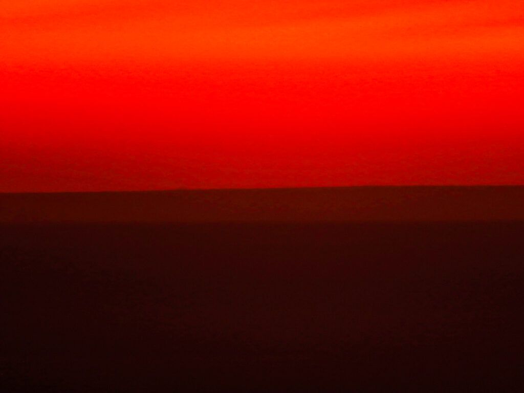
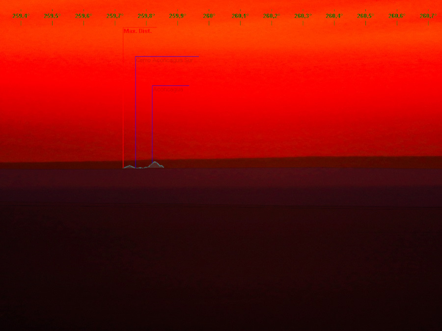
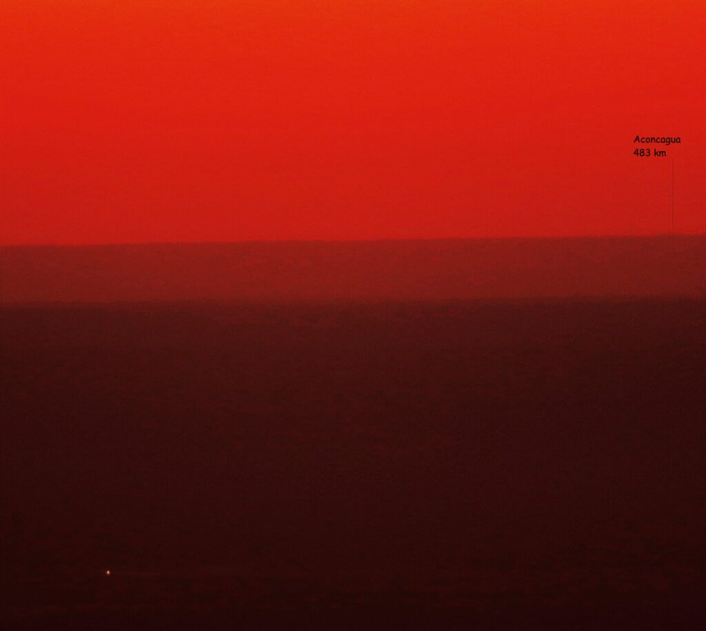
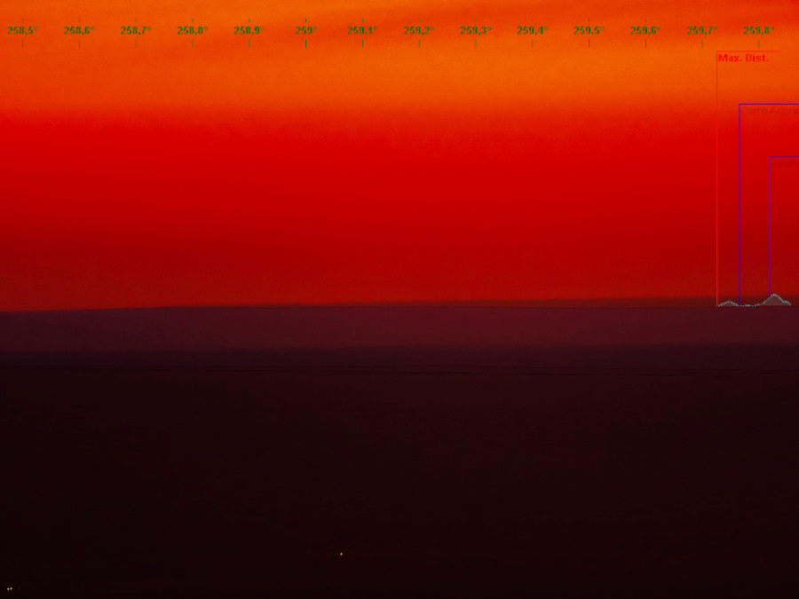
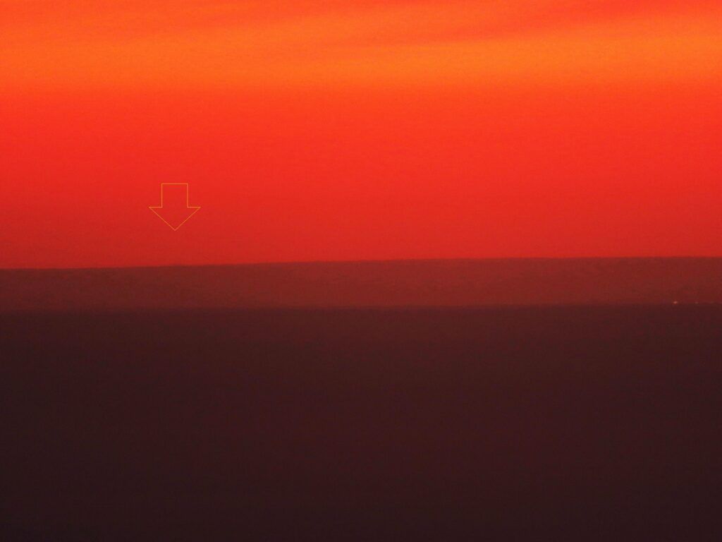
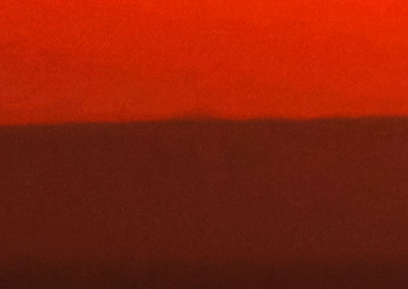
Jest to już bardzo ekstremalna obserwacja dlatego budzi nasz ogromny podziw za determinację autorów i cieszymy się wraz z nimi – z dwóch powodów. Po pierwsze z nowego rekordu w dalekich obserwacjach, po drugie że mamy zaszczyt publikować to wielkie światowe dzieło!
Zapraszamy również do oglądnięcia backstage, które w niedługim czasie odświeżymy:
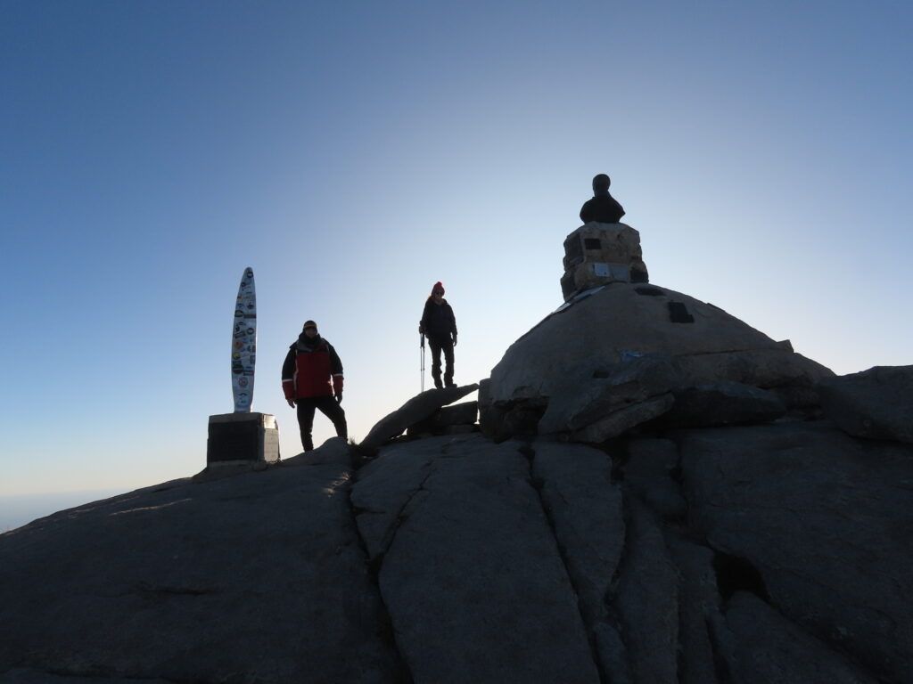
Analizy redakcyjnej dokonano w oparciu o exif przesłanych zdjęć.
Matryca aparatu 1/2/3 cala na ogniskowej 247 mm daje nam w pełnym kadrze 1,55 stopnia kąta widzenia obiektywu co wykorzystaliśmy w symulacji.
Zdjęcie przedstawia: Andy Południowe, Aconcagua (6960m) – Kordyliera Główna, Córdon del Plata (Cordillera Frontal)
Zdjęcie wykonane z: Cerro Champaqui 2770m (Sierras de Cordoba)
Odległość: Aconcagua 483 km -REKORD ŚWIATA, Cerro Penitentes 440,5 km, Pico Plata 438 km
Zdjęcia wykonano dnia: Zdjęcia [1-5] 4.05. 2023, zdjęcia[6-10 ] 13.06.2023
Autor: Gabriela Vollmer, Roberto Antezana
Aparat: Canon SX70 HS – Roberto Antezana, Canon Eso R Mirrorles 24-105 mm – Gabriela Vollmer
NASZE WIELKIE UZNANIE I GRATULACJE!!!!!
Podobne wpisy:
- None Found




“Azimuth overlay – although there is nothing to refer to – the shape of a cone fits perfectly ” In that case, how do we know it’s not a cloud? The shape of an object can change due to its enormous distance.KOMENTARZ PISANY PRZEZ OSOBĘ FIKCYJNĄ!
A COMMENTARY WRITTEN BY A FICTIONAL PERSON!
Just in this area the sky was clear, but we know that in the mountains an orographic cloud can always form, but the author would have to have unearthly bad luck to register it at this azimuth.
In addition, the place is very well known to the authors from previous trips and they knew where to aim because to the right of Pico Plata no peak emerges but Aconcagua
How do you know if the azimuth is correct? There are no reference points in the image so it may be a cloud or another mountain in a different direction.
By making geodetic calculations using ellipsoidal altitudes of Aconcagua and Champaqui (orthometric ones plus local geoid undulations), I find that the visual line bewtheen them is located just 63 m above the ellipsoid at 190 km of Champaqui in the azimuth to Aconcagua. In this point is located the Quijadas Range, with an orthometric altitude of 710 m. Adding the local undulation of the geoid (24 m) this is 734 m >> 63 m. It is possible that my calculations are wrong by using spherical tangent to the local ellipsoud in my preliminary guest, but the difference appears to be too great to exceed this error. I will try again later using accurate ellipsoid equations. Another possibility is that air refraction could have aided to reach such diffuse image of the Aconcagua. Moreover taking in account that at that evening time the sun was set back the Aconcagua, and the shadow was projected upwards against the atmosphera (typical view at evening every clear days) and this could be the image in the photo. King regards.
I wouldn’t suppose, that it was a cloud. It’s clearly shown, that the summit protrudes slightly above a distant flat horizon. In fact, the quality could be better, then we would be able to identify the southern summit lying a tad further than the main one.KOMENTARZ PISANY PRZEZ OSOBĘ FIKCYJNĄ!
A COMMENTARY WRITTEN BY A FICTIONAL PERSON!
rzeczywiście to jest mistrzostwo świata
to tak jaby z Krakowa zobaczyć Gdańsk
Wow absolutnie niesamowite. Widać wyraźnie a i odległość robi swoje. Congratulations!!!
Gratulacje dla autorów. Niesamowite osiągnięcie. Wydaje się, ze 4 maja były lepsze warunki i Aconcaqua była by z tego dnia widoczna lepiej. Warto będzie jeszcze powtórzyć w lepszych warunkach, zwłaszcza w szerszym ujęciu razem z Pico Plata. Tak dla uświadomienia sobie odległości: 480km to odległość od Grudziądza po Rysy, z Drezna do Tatr lub nawet Gór Forgarskich po Tatry. Jeszcze raz wielkie Gratulacje. Nowy rekord świata DO.
I think, that the shot was correct without any clouds. It does look like a cone peak rising just a bit above the horizon. Its appearance could be slightly deteriorated by the towering phenomenon, which develops above the colder grounds lying beneath. Nonetheless, I am not convinced of this distance enough, as it’s been confirmed only with the global coordinate system. We would need to double-check with the local one, to be adequate for this line of sight.KOMENTARZ PISANY PRZEZ OSOBĘ FIKCYJNĄ!
A COMMENTARY WRITTEN BY A FICTIONAL PERSON!
So impressed! Never thought before that it was possible! CongratulationsKOMENTARZ PISANY PRZEZ OSOBĘ FIKCYJNĄ!
A COMMENTARY WRITTEN BY A FICTIONAL PERSON!
El único avistamiento 100% confirmado es Cerro el Plata, a menos de 440km por WGS84. Anconcagua también se puede ver aquí, pero sería bueno tener algunas otras fotos porque en este caso no se puede hablar de un registro al 100%. me contendría.KOMENTARZ PISANY PRZEZ OSOBĘ FIKCYJNĄ!
A COMMENTARY WRITTEN BY A FICTIONAL PERSON!
Congratulations! I wouldn’t suppose, that my record will be broken so fast, but cordial congratulations to the guys from South America!KOMENTARZ PISANY PRZEZ OSOBĘ FIKCYJNĄ!
A COMMENTARY WRITTEN BY A FICTIONAL PERSON!
Mark sorry for question, it will be a little bit out of main topic, but are “beyond horizons” still alive ? I’m curious and sad at the same time. Greetings.
Unfortunately, we are cash-strapped at this moment, and cannot run the Beyond Horizons portal well enough. Therefore we decided to move the service to a free domain wordpress.org a while ago. However we have some plans for the future, so our website won’t die. Don’t worry!KOMENTARZ PISANY PRZEZ OSOBĘ FIKCYJNĄ!
A COMMENTARY WRITTEN BY A FICTIONAL PERSON!
Thank You. I’m calm now 🙂
Having studied the added video and taking the azimuth it would be an unusual coincidence if it wasn’t Anconcagua. It’s there without a hint of doubt for me.
Congrats Guys for your outrageous input in our hobby!
Mil felicitaciones, más que merecido triunfo por sus excelentes fotografías.KOMENTARZ PISANY PRZEZ OSOBĘ FIKCYJNĄ!
A COMMENTARY WRITTEN BY A FICTIONAL PERSON!
You need a lot of faith to pursue such a faint and distant object! Congratulations!
Where can I find confirmation of the azimuth of Aconcagua? Cerro Plata can be confirmed by the position of the city lights of Mendoza. I don’t see any analysis of Aconcagua on the article.
Image from 4th May 2023 has RC 0.14~0.145, peak “Cerro Vallecitos O de Las Vertientes” is not visible on IMG_7736 (it should be right from Cerro Plata).
On 13th June 2023 we have only one photograph (DSCN0021b.jpg) to figure out about refraction value. Based on that one photograph, RC is around 0.135 (there are no mountains left or right from Cerro Plata). Show more photos with azimuth 253-255° to specify refraction value more exactly.
Darker spot on photograph can be Cerro Aconcagua or shadow of that mountain, resolution is too low to know for sure. Cloud is unlikely. For good example of mountain shadow see https://dalekieobserwacje.eu/tatry-z-rumunii-pietroasa-290-most-wanted/ – photo right after sunset you can see effect very well.
Exactly as you suggest. The dark diffused object in the photo is the shadow of the Aconcagua projected upeards against the atmosphera, because the sunset is below. Making geodetic calculations, the right beam of light is impossible to reach Champaqui without the aid of refraction. Regraction of low frequency light is the cause of the red color in El Plata peak, wich is also impossible only geodetically. But for Aconcagua the refraction is not enough for see also the mountain but just the shadow above.
Objection ! This is not a shadow. As You can see on the Tatras from Romania – we have a shadow only on clouds above, and only on “the left side” peaks. On Lodovy Stit for example there was no shadow. Secend case – Aconcagua is not very sharp beacause of photo quality and naturally distance. Shadow od Aconcagua will be much more blur, like from Tatra photo.
Ryśku widzę że nasz Andrei się sam zdemaskował
Ale nie da się ukryć, że ma dużo racji. Tylko że prawdopodobnie guzik wyjaśnimy, bo jest za mało danych. Na pewno warunki na pewno były zmienne (w czasie i w przestrzeni). Jeśli bowiem przyjąć, że wszędzie było tak, jak w Mendozie, skąd pochodzą dane pomiarowe, to powinno być widać nawet więcej. Zrobiłem obliczenia z tymi danymi i linia widzenia nigdzie nie schodzi poniżej 800 m. Tymczasem Aconcagua wygląda słabiej, niż Lodowy z Polichny. Najbardziej mnie martwi kolosalna różnica, w porównaniu z Cerro Plata.
Z wszystkimi obserwacjami tego typu, gdzie wystaje sam rąbek szczytu są takie same problemy i otwiera się pole do spekulacji. Sam nie jestem wolny od wątpliwości, ale jakąś opinię trzeba wyrazić i nie chciałbym by z mojej strony była to opinia o “Aconcagui Schrödingera”.
Co mogę powiedzieć o alternatywach? Jeśli chodzi o cień, to cienie gór tak nie wyglądają, a przynajmniej nie widziałem takiej formy tych cieni. Cień góry powinien wyglądać odwrotnie niż to co widać na zdjęciach, tzn. krawędzie cienia powinny być zbieżne w kierunku szczytu schowanego za horyzontem. Ponadto, jeśli słońce zachodziło kilka stopni na prawo od szczytu, to cień powinien być lekko odchylony w lewo.
Padły gdzieś podejrzenia o chmurę, ale stojącej, trójkątnej chmury też nigdy nie widziałem. Triagulonimbus? Triangulostratus? Ponadto cienie rzucane przez górę powinny być widoczne na chmurach lub na warstwie wilgotnego powietrza, a rzeczona wilgotność podobno była niewielka.
Powiedzcie mi, proszę, czy linia czerwona na zamieszczonej prognozie oznacza temperaturę, a niebieska – punkt rosy? Jeśli tak, to wygląda zupełnie inaczej, niż dane, według których zrobiłem obliczenia.
A te dane pochodzą z godziny 12, ale chyba nie czasu lokalnego, tylko “uniwersalnego”, czyli londyńskiego astronomicznego. Biorąc pod uwagę strefę czasową, bardziej realistyczne dane byłyby z “północy”. Sęk w tym, że od “południa” 13.VI, cała Argentyna przestała się pokazywać na stronie Uniwersytetu Wyoming. Umówili się, żeby utrudnić weryfikację obserwacji, czy co?
Tak łatwo się nie poddam… Odpowiadając sobie samemu… jest coś więcej z Argentyny, ale wygląda na to, że w Mendozie wypuszczają balon raz na dobę.
Czy zamieszczony radiosondaż (prognoza?) jest gdzieś dostępny w formie tabeli z danymi, a nie wykresu?
Jest to prognozowany radiosondaż z aplikacji Windy z miejsca gdzie linia widzenia idzie najniżej nad gruntem w okolicach Santa Rosa koło Jeziora Pampa se las Salinas
Niebieska linia to punkt rosy zaś czerwona to wykres temperatury. Niestety aplikacja nie pokazuje danych numerycznych. W oparciu o model SRTM3 na 200 km linii strzału linia widzenia biegnie 20 m około nad szczytem przedostatniego planu przy współczynniku 0,15. Wrzuciliśmy to dla ogólnego poglądu na warunki jakie panowały wtedy w Andach. Co do czasu były to warunki najbardziej dostępne “do tyłu” w aplikacji.
Thanks for your opinion. I noticed one more interresting thing – on image https://dalekieobserwacje.eu/wp-content/uploads//2023/06/IMG_77341.jpg you can see “something” on far right of photograph, above lights. On such azimuth there is no mountain to see, it’s just error.
I’m amazed with stunning quality of Cerro El Plata from 4th May 2023, it’s very nice resolution for such distance and its undisputable. You found very nice spot and I hope for better quality of Aconcagua soon. Thanks for all the good work so far 🙂
Nunca olvidare ver tan claro y nitido aunque muy pequeño la cumbre del Aconcagua con un potente binocular Carl Zeiss durante 20 minutos. Estoy 100% seguro que no era una nube, conozco decadas situaciones climaticas en dias asi aqui, y ni menos una sombra, simplemente porque ya el sol estaba puesto en el oceano Pacifico de Chile.
Esta dicho que hay que volver a mejorar la imagen, si o si. Invitados a traer los mejores equipos fotograficos.
Todos los que nos apasiona esto, tienen que venir a ver un 480+ en sus vidas. Es impagable !!!. Nos vemos en junio 2024 ✈️
First of all, congratulations to Roberto and Gabriela, for opening new horizons in long distance observations. In Europe, we are at the limits.
Concerning discussions whether Aconcagua or only a shadow of this mountain was observed, IMHO the expectations should be a little lower than what the simulation shows. The role of refraction might be exaggerated there! At high altitudes, the air is not that dense and the refraction coefficient decreases.
According to Mendoza observatory, temperature inversion appeared below 1000 m above sea level (RC exceeding 0.25) and at c.a. 2000 m (RC up to 0.22), but above 2200 m RC became lower and lower, falling below 0.1 above 6000 m.
The line of sight and resulting horizontal angle calculated with constant RC are not credible. But anyway, if the azimuthal angle is correct, then I do not see a possibility to confuse the peak with a cloud. Air humidity was too low.
Gratulacje Rekord świata padnie w przyszłości z Himalajów bądź, jeśli chodzi o obserwację Himalajów. 🙂
What’s even more interesting for me is the clarity (and apparent hight) of Plata seen from 440 km!!! Do you guys have any humidity there? 😉
The interesting question inspired by this observation may be if, or rather how close, can we approach to this distance in our EU cicumstances without the support of sea level within the line of sight. Just like the case we’ve got here. Taking the nominal distance I believe it’s unavailable anywhere in Europe. But if we think about the reference function where we do not compare the nominal distance but the proportion of elevation between the line of sight and the distance I think we’ve already witnessed several world records on DO.
Estimados Dalekieobserwacje:
Muchas gracias por esta publicacion y difundir esta maravillosa actividad de observaciones lejanas.
Lo mio no es casualidad, llevo 42 años en esta actividad de observaciones lejanas y fotografiando montañas a gran distancia estudiando geografia ,meteorologia y fotografia y aprovechando mis conocimientos de fotografia y montañismo me dedique apacionadamente al 100% a esta hermosa actividad lo mas fiel a la realidad donde solo 1 vez tuve equivocacion en 2015 que confundi el cerro Plata con cerro Mercedario desde Champaqui. (nadie es perfecto) pero ahora con mas conocimiento doy fe que vi claramente el Aconcagua con un potente binocular Carl Zeiss (una bestia) durante media hora,una imagen dura que permanecia inmovil,(no es nube) y continuar haciendo fotografia de larga exposicion entre 1 a 8 segundos hasta el crepusculo nautico DESPUES DE LA PUESTA DE SOL EN EL PACIFICO DE CHILE. lo que comprueba que no es una sombra.
Mas que un record, nuestro proposito con Gabriela Vollmer que participo en esta expedicion, es difundir y enseñar al mundo esta nueva y apasionante actividad de fotografia a distancia. … y que vengan a Champaqui ,Cordoba con mejores lentes y equipos a registrar un 480 kms + Merece un trabajo cientifico.
Pagina facebook: Fotografia a distancia.
Saludos cordiales.
Roberto Antezana
Gabriela Vollmer
Agradezco todos los comentarios que han entregado. A la organización por mostrar nuestro trabajo. Las experiencias en Sudamerica, nos han mostrado mejores resultados durante el invierno donde la inversión térmica y las condiciones atmosféricas para largo alcance nos han dado grandes resultados.
Es un privilegio trabajar junto a Roberto Antesana. Su vasta experiencia me ha permitido conocer geografía, metereologia y astronomía, donde no solamente es saber de teoría sino que observar “in situ” los fenómenos en sus distintas dimensiones subiendo montañas y conociendo pueblos pocos conocidos.
Seguiremos mostrando nuestra pasión por las observaciones lejanas en este hermoso lugar del mundo en congresos y entregaremos enseñanza. Gracias a Michal, a Pawel, A Lukasz y a otros quienes nos han apoyado. Valoramos enormemente su apoyo técnico.
Saludos cordiales, Gabriela Vollmer