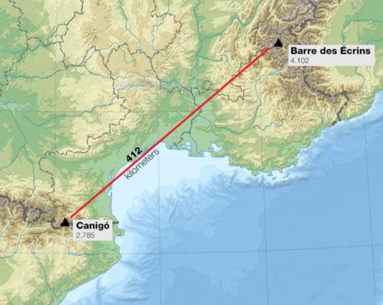
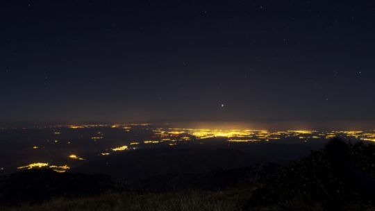
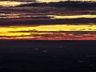
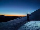
Barre des Écrins widziany z Pic du Canigo [412 km!]
Zdjęcie przedstawia: grupę Écrins w Alpach Delfinackich (Francja) z najwyższym szczytem Barre des Écrins (4.102 m n.p.m.)
Zdjęcie wykonane z: Pic du Canigó (Pireneje Wschodnie, Francja, 2.784 m n.p.m.)
Odległość: do Mont Ventoux – 293 km, do Barre des Écrins – 412 km
Zdjęcie wykonano dnia: 2017-08-12
Autor: Juanjo Diaz de Argandoña / Marc Bret
Aparat: Nikon D5100 @ ED80 APO Refractor Telescope
Autor: Juanjo Diaz de Argandoña / Marc Bret
Aparat: Nikon D5100 @ ED80 APO Refractor Telescope





W poprzednim poście wspominałem, że granica publikacji na DO to teraz chyba 300 km. Byłem w błędzie! Min. to 400 km 😉
Żarty żartami, ale ze zdjęć wynika że maks. to 416 km, a nie 412 km jak w opisie.
Niesamowita obserwacja, gratulacje ! Ciekawe jak często zdarzają się w tamtym rejonie takie warunki. Z odległości prawie 300 km widać 50 metrową wieżę na Mont Ventoux.
Autorzy chyba czymś takim się posłużyli…..
http://www.telescope.com/Telescopes/Refractor-Telescopes/Refractor-Optical-Tube-Assemblies/Orion-ED80-80mm-f75-Apochromatic-Refractor-Telescope/pc/1/c/10/sc/346/p/9895.uts
@majkel – tak, ale nie ma się czemu dziwic. Żeby z 400 km góry były tak duże i wyraźne, to po pierwsze musi być teleskop, a po drugie musi być to apochromat – jak na letnie warunki i odległość obrys gór jest niesamowicie ostry.
No czad na maksa.
To ja już lepiej się schowam z tymi moimi zdjęciami z Appalachów na 100km … 🙁
obliczy ktoś krzywizne ziemi? czy jest możliwość zobaczenia takich odległości z tych wysokości?
Niesamowita, wręcz metafizyczna obserwacja na granicy absurdu, fascynujące.
Najwyższej jakości zdjęcia, bardzo dobra robota.
Czapki z głów… Kosmos… 😀
To już trąci abstrakcją.
Kto wie, jaki jest teoretycznie najdalszy możliwy “strzał” w Europie?
Witaj znajomych. Szersza perspektywa różnych sektorów Alp z tego samego dnia, można zobaczyć tutaj:
http://www.alpen-panoramen.de/panorama.php?pid=32809
Good to… read you, Marc! We are astonished with your latest delivery. I become more and more curious about what determines such great visibility conditions when the air seems to be perfectly transparent. Do you have any weather data from this region before and after the shots? Were there any heavy storms a day or two before? Does it have any correlations with rising or falling atmo pressure? I would also like to know, how these pictures were photoshoped and the difference between the screen and eye views.
Noneoftheless, very deep bows for such unmistakable 400 km!
@Laus: Marc Bret przeprowadził i uwiecznił właśnie najdalszą możliwą obserwację w Europie, przynajmniej bez “cudów inwersyjnych”.
Przepraszam, pomyliłem się. Najdalszy “strzał” jest z Pic de Finestrelles (440 km). Sęk w tym, że Mark Bret uwiecznił już także ten widok, tylko zamieszczony został gdzie indziej.
https://beyondhorizons.eu/author/amoralaire/
Cytowana obserwacja została gdzieś podważona, chyba na astropolis, stad zdecydowaliśmy sie jej nie publikować. Niemniej wymagałaby głębszej analizy, żeby wypowiedzieć sie kategorycznie. Tutaj mamy do czynienia z czymś niepodważalnym, BdE jest na zdjęciu, a nie jest czymś, co “wyszło” po obróbce. Rzekłbym nawet, ze obserwacji brakuje atmosfery mglistosci charakterystycznej dla rekordów DO.
Bardzo dalekie obserwacje możliwe są jeszcze z Gór Białych na Krecie w kierunku Grecji kontynentalnej. Ilekroć tam byłem za każdym razem trafiałem na “rekordowe” warunki atmosferyczne, niestety zawsze z powierzchni gruntu. Świadczyłoby to o tym, ze zaliczenie rekordu nie będzie tam niczym specjalnie karkołomnym (nie wiem tylko jak z wchodzeniem na szczyty).
Jeszcze na marginesie. Tego typu obserwacje zawsze uznawałem za swego rodzaju handicap wynikający z przecięcia na linii patrzenia powierzchni wody, która przecież jest nieobojętna na przejrzystość powietrza, nie mówiąc o braku przeszkód terenowych. Oczywiście nie umniejsza to w żaden sposób jej niezwykłości, jednak zaryzykowałbym stwierdzenie, ze takie Tatry z Salomona czy Klosterwappen z Pradziada to osiągnięcia zasługujące na miano rekordów świata na równi z tym, nie za względu na odległość, ale właśnie topografie.
Hello Mateo. I certainly do not know because there is not in DO the photograph that I made the month of July 2016 from the Finestrelles!
I can offer you all the details that you would want about the photographs. All photos of that day have been here for more than a year: https://www.flickr.com/photos/markbret/albums/72157668339813284
There is an extensive report in my personal blog of distants horizons, in Catalan: https://horitzonsllunyans.wordpress.com/2016/07/26/els-ecrins-des-del-finestrelles-i-n-possible-record-mundial -de-retrat-de-paisatges-distants /
Also in Spanish version: https://ventanasdeaire.wordpress.com/2016/07/23/los-ecrins-desde-el-pirineo-440-443-km-nuevo-record-de-de-mundial/
The report on the shared web of Beyondhorizons I think you know it, obviously.
Also on facebook: https://www.facebook.com/pg/horitzonsllunyans/photos/?tab=album&album_id=524213501096400
About the dispute that arose with respect to the photograph taken from Argentina it was totally resolved. I showed clearly that the photo from Argentina corresponded to other closer mountain, and not to the Pico Mercedario. Everything is explained with a lot of details in the post of the facebook of D.O. Also on our website Beyondhorizons and other sites.
On the photos of the Finestrelles I apologize that I am not Polish and the translator google I think it fails a little and I find it difficult to understand. I’m not sure what you mean by “Bde” in your comment.
Also comment on some of the haze. Do you find there is too less mist in the photo? That day there was a very good transparency and I purposely chose that day for the attempt, it was not by chance. Circumstances similar to that date it was the past 17 of August and for this also appeared the Alps.
But it is not the first time or the second time. After making the attempt from the Canigó in 2014 to full backlight of the sun and achieve with my colleagues the first images, I have been portraying the Alps from the Pyrenees without the direct help of the sun since January 2015. The first time was a daytime attempt des of the Puig Ombriaga and resulted an extremely tènue.
https: //www.flickr.com/photos/markbret/16984273540/in/album-72157661479475339/ It was a world record but I did not publish why I did not get to see with the naked eye, only to see the photograph and I decided to try to get it better, with more clarity.
It happened a whole year …
without succeeding.
In February 2016 I finally got a better weather and I managed to do a daytime photograph (my purpose was to get the snow from the Alps too and this is not possible before the sun rises) from a little further. The Pic of Bastiments. https://www.flickr.com/photos/markbret/albums/72157664844569041
The previous day I also portrayed them, but with much atmospheric distortion.
Then in April of the same year I photographed them quite well, the silhouettes before a sunrise, from Pic de La Dona. https://www.flickr.com/photos/markbret/albums/72157667276445196
Finally and seeing that I was hitting the right weather conditions I decided to try it from the Finestrelles, which is the maximum possible distance from Europe, I had analyzed years ago.
I went with a colleague (Marc Larroya) and got to portray them: https://www.flickr.com/photos/markbret/albums/72157668339813284 I think it was the best visibility day of the whole summer.
Then also on August 7, 2016, guessing another favorable situation I went to portrayed them, again from the Pic de La Dona. https://www.flickr.com/photos/markbret/albums/72157685938415920
In this year (2017) I have gone much less to the Pyrenees because during the winter and spring I had other objectives (not alps) from other places.
On July 28 I returned and managed to portray them very faintly from the Gra Fajol https://www.flickr.com/photos/markbret/albums/72157684251946321
And in this month of August, seeing that a fantastic meteorological situation was approaching for the 17th I decided to go to Canigó and together with my colleage of BH we portrayed this time not only the Ecrins but also other peaks that only from the Canigó are possibles. https://www.flickr.com/photos/markbret/albums/72157687746117745
In the following week (August 20), although the weather forecast was not so favorable, I went back to try to portray another part of the Alps that had not been seen the previous week, and I did it https://www.flickr.com/ photos / markbret / albums / 72157687785302746
Any of these photographs if you are of interest you can put them in D.O.
I would appreciate that at least you put the one I made from the Finestrelles, which also has the singularity that it is a world record away.
If you have any doubt you can ask me what you want, if you want me to show you other photos that I have not put on flickr too, although I think I have already provided numerous tests.
About the meteorológical factors. Perhaps it may seem very difficult to portray the Alps at more than 400 km but from my experience I say that there are certainly other objectives much closer but in practice more difficult than the Alps.
The photographs I have taken of the Alps in my case are due mainly thanks to my experience accumulated with other distant reliefs, usually more difficults and the study of the factors of visibility.
Since years ago, I set out to see Mallorca from Barcelona, a goal not too far in comparison (190 kms) but that requires good atmospheric transparency because the sunrise is in a far angle and it was basically my self-learning for the others challenges.
The Alps from the Pyrenees are very distant but in spring-summer they enjoy the proximity of the angle of the sunrise. This allows that in conditions of transparency not extraordinary, can be seen and portrayed, without help of photoshop techniques. All my photos are without photoshop or lightrom or similar. And I did not even shoot Raw. With these techniques it would still be much easier of course, and in infrared even more!! but it is not my goal. Only I want to portrait what I can see directly.
On the other hand the region of the south-east of France is a geographical zone in which the air is often very clean and dry; I think it is a very privileged region of Europe in this respect. The katatic winds of the west arrive dry to the sea with a slight fohën effect and the coast and zone of sea where the line of visibility runs with the help of the refraction is very transparent in that conditions. On the other hand when the winds come down from the Alps also dry up on the coast.
At a broader level, the circumstances that facilitate the sharpness I have discovered that are especially the intense atmospheric subsidence from the middle and upper layers of the atmosphere and also the procedence. The mass of air almost always coming from the region of Canada. It is also favorable that in its route in previous days, the mass of air has crossed some low pressure in the Atlantic. Probably the air clean in that process. It is important that the anticyclone is close to a low pressure system that absorbs in another area the surface flow and allows a more intense dynamics of subsidence. The zones of interconnection between the ridge of a strong anticyclone and a system of low pressure that moves away are the most favorable. The presence of a warm front but attenuated by the same anticyclone (so non-active front). The elevation of temperature in dry air conditions is important, especially moreover after a cold days with precipitations. In the upper atmosphere, the presence of cold air at 200 hpa also has good correlation with the described factors. Also enhough wind at middle levels, stronger that in low levels.
By the way also, it is much more important that the air is clean of particles than the fact that it is dry.
The moist air (except 100% of Hr) is very transparent if there are no condensation nuclei. It is important that there is no pollution so that aerosols do not form.
Atmospheric dispersion is a less bad factor than absortion. Moisture-induced scatter prevents the perception of relief when there is a lot of light (the sun is already on the horizon) but it is not a big problem before the sun rises. The absorption of light-induced by dust or aerosols of pollutants of considerable size if that is really harmful.
Atmospheric air subsidies from high levels and the Arctic procedence often guarantee clean air in the west of mediterranean area.
I don’t know if in the east of Europe the good factors are similars. I think that the majority yes but may be not in the same degree of importance of each one. The characteristics of air that come to the french coast usually are differents that the case of arrive to others parts of Europe because the trajectories obviously are differents and the geography have influences in the changes of values of the principal parameters.
About the brightness of the sky, it’s important good luminosity in the upper and middle layers of the atmosphere that are behind the silhouettes, so it’s important not dense clouds either dirty humidity aire between the position of the sun and the part of that sky; this it’s especially important in case if the position of the silhouettes are in opossite angle of sun.
in case of observations with the sun with similar direction before sunrise or after sunsets a little high clouds or humidity in high levels can be good if that clouds make a dispersion of light in the close angle of sun. The humidity generate a good dispersion of light that is good if is concentrated only behind the silhouettes and produce very good contrast. In lower levels dry air is better in all types of circumstances.
In case of mountains with snow.. Distant silohuettes with the reflecttion of snow can be seeing from extrem distances during the day if the air is clean. If the sun is in 90ºdegrees positions, a picture made with polariser filter help a lot, although We can ask if using a filter is in accordance with our criterion of enjoying photos taken with this method, because this is a trap in relation to our natural contemplation. Other equivalent reasoning can be done with respect to other types of filters and techniques. I think it’s okay for everyone to enjoy the scenery of landscapes in their own way and report how they do it.
Czy mogłabym prosić Was o pomoc? w jaki sposób mogę stworzyć panoramkę z opisami szczytów tak jak tutaj jest? to jakiś program czy strona WWW? poratujcie jesli możecie:)
http://www.udeuschle.de/panoramas/makepanoramas.htm
Od publikacji Hochschwaba z Brna minęło pełne 7 (siedem) miesięcy. W międzyczasie imponujący rekord świata DO, ale co z “miejscowymi” obserwacjami z PL/SK/CZ? Poproszę o jakiś komentarz, bo naprawdę szkoda tej strony..
@UKraina: niestety, DO zapadły, w tym roku, w coś w rodzaju letargu. Czasem się budzą, publikują coś mniej lub bardziej spektakularnego i znowu zasypiają. Mam tylko nadzieję, że nie na zawsze.
@Marc Bret: Your comment has been published only a few days ago. This comment has probably been blocked by an algorithm because of the large number of URLs and then read and allowed by a human after such a long time. Same has happened with my – even older – comment I have written for another entry. I have seen the observations you have published, including that from Finestrelles and I find them absolutely credible. I have no idea why could it be questioned. BTW, Bde in mateo’s comment stands for “Barre des Ecrins” :-).
Wg kalkulatora krzywizny ziemi widoczne powinno być około 200 m szczytowego odcinka góry. Widać znaczną część masywu. Niech każdy wyciąga wnioski sam.
Na dystansie 443 km występowałby na kulistej ziemi o obwodzie ok 40 000 km spadek terenu o ok 15.4 km, więc nie jest możliwa na kulistej ziemi taka obserwacja, dodatkowo perspektywa sprawia, że obiekty o wielkości kątowej mniejszej niż 1/20 st kątowego są niewidoczne co sprawia, że obserwacja by była widziana tak jakby spadek na takiej odległości wysiółby ponad 20 km co jeszcze bardziej przeczy możliwości takiej obserwacji na kulistej ziemi. .. Tym bardziej, że w takiej odległości góry by były obserwowane pod kątem od nas, a na tym zdjęciu nie są, no i to dodatkowo zwiększa obserwowalny spadek na takiej odległości przy kulistej ziemi do grubo ponad 20 km… Są też obserwacje z ok 480 km, a nawet 500-600-700 km, nie potwierdzone, ale zdjęcia można znaleźć w internecie i przeanalizowac , bo w takiej odległości nie jest możliwe na kulistej ziemi wykonywać obserwacji jak na zdjęciach. . Bo obserwowane góry byłyby … kilkanaście , a przez pochylenie i perspektywe nawet kilkadziesiąt km pod horyzontem.. Tutaj jest obserwacja z wysokości 2748m więc ukryte powinno być ok 5.1 km, widoczne szczyty są niższe, do tego perspektywa ucinająca 1/20 st, taka obserwacja nie jest możliwa na ziemi o obwodzie ok 40 000 km..
Pamiętaj, że nie można tutaj wstawiać refrakcji, po pierwsze dlatego, że występuje ona w bardzo specyficznych warunkach, a ja mam taki widok zawsze gdy jest przejrzyste powietrze, po drugie zniekształca obraz, po trzecie nikt nigdy nie udowodnił, że może coś wyciągnąć z pod powierzchni ziemi, może tylko widoczny obiekt obrócić, przechylić czy wynieść ponad ziemię albo schować pod ziemię, po czwarte, musielibyśmy znać temperaturę i skład powierza na całej długości obserwacji, natomiast trzeba uwzględnić perspektywę czyli brak widoczności od dołu obiektu o wielkości mniejszej niż 1/20 stopnia kątowego bo to jest zbadane eksperymentach naukowymi i doświadczamy tego na codzień nawet w tak oczywistych obserwacjach jak w korytarzu na dalekich lampach na suficie czy na ulicy w oddalajacych się latarniach. ..itp, itd., potrzeba nauki a nie pseudonauki , sprawdź sobie definicję obu. .
Na takim dystansie obserwacja jest spokojnie możliwa i to jeszcze w zakresie geometrycznym. Jak chodzi o refrakcję, to nie zachodzi ona tylko w próżni. W ośrodku takim jak ziemska atmosfera zachodzi zawsze i to nie tylko dla fal z zakresu VIS. Podrzucam proste wyprowadzenie wzoru, które pozwala sporo zrozumieć. Macie jeszcze chwilkę na kliknięcie w link zanim moderator “wirtualną myjką ciśnieniową” spłucze wasze teksty tam gdzie ich miejsce: do internetowego szamba 🙂 Miłego wieczoru. http://www.refraktor.pl/2015/12/snellius-vs-pitagoras-10.html
Kolego @ Czarny. Mimo iż niedziela trwa i człowiek powinien odpocząć po całym tygodniu orki na ugorze solennie odpalam wirtualne jak to nazwałeś wysokociśnienowe ustrojstwo i rozpoczynam mycie. Mam nadzieję że rynsztoki wytrzymają choć po ostatnich ulewach mocno je pokiereszowało…
@Czarny: czysto geometryczna (czyli ze światłem rozchodzącym się po liniach prostych) obserwacja z Finestrelles nie byłaby możliwa, nawet przez morze. Luki87km musi pisać o niej, bo wymienia 443 km. Z refrakcją – jak najbardziej! Dla porządku: refrakcja nie zachodzi także wtedy, gdy patrzymy pionowo do góry :-). Astronomowie mówią wtedy o zenicie. Poza tym, masz absolutną rację – atmosfera nie jest optycznie jednorodna, a refrakcja występuje zawsze, gdy istnieje niezerowy gradient współczynnika załamania światła, prostopadły do kierunku rozchodzenia fali świetlnej. Aż kiszki się człowiekowi skręcają, gdy po raz nie wiadomo który musi o tym przypominać. Milczeć jednak nie można, bo wzgarda zostanie przez drugą stronę rozpropagowana, jako brak argumentów przeciwko płaskoziemstwu :-).
Z tych wszystkich głupot podoba mi się to zdanie:
” nikt nigdy nie udowodnił, że może coś wyciągnąć z pod powierzchni ziemi, może tylko widoczny obiekt obrócić, przechylić czy wynieść ponad ziemię albo schować pod ziemię”
Tak satyrycznie to z pod powierzchni ziemi można wyciągnąć górnośląski węgiel, można go obrócić, przechylić, nasypać w hałdę ponad ziemię a potem go wsypać znowu pod ziemię.
Tak na serio to nawet gdyby brać “powierzchnię ziemi” sensu płaska ziemia.. Wulkany plują lawą z pod powierzchni ziemi, wybuchają, czy się nigdy nikt z fanów płaskiej ziemi nie zastanawiał nad takimi przyrodniczymi zjawiskami. Zacznijcie od tego a optykę może kiedyś też zrozumiecie, tymczasem dalekie obserwacje zostawcie w spokoju bo ich nie rozumiecie.
Zresztą jak widać na zdjęciu i jego opisie, widać cały masyw, a nie sam szczyt co jednoznacznie potwierdza płaskość ziemi, bo wg kalkulatora krzywizny ziemi nie powinno być widać nic uwzględniając pochylenie gór, widać natomiast wyraźnie wszystkie szczyty, jak i masyw, nawet wzgórza, od podnurza, jednoznacznie to potwierdza płaskość ziemi, wystarczy pomyśleć samodzielnie..
Niestety, ale umowy z NASA, ESA, SpaceX, ZAiKS i PSL nie pozwalają nam byśmy przestali uznawać teorię heliocentryczną oraz liczyć refrakcję. Przykro nam, proszę sobie myśleć samodzielnie w samotności.
Pewnie, że będę myślał samodzielnie, a jeśli za ciebie mają myśleć jacyś złodzieje z NASA, ESA, itp, itd biorące od podatników miliardy dolarów miesięcznie N grafiki komputerowe to twoja sprawa, no lepsza samotność gdy się myśli samodzielnie, niż bycie w tłumie i myślenie tak jak tłum..
luki87km…. Podzieliłbyś się dostępem do zioła którym się sztachasz????
Luki87km – Michał jakiś czas temu wykonał z kolegami zacną obserwacje Tatr z góry Chełmo. Wystają tam wierzchołki poszczególnych szczytów Tatr Wysokich a wg płaskich ziemców powinny być widoczne całe Tatry od podnóża. Proszę o komentarz i argumenty.